Vacant Land Elements Examples by Type
Context
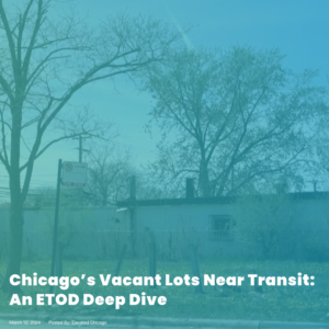


Elevated Chicago
In Elevated Chicago’s report, a case study of two areas in Chicago near transit hubs discuss the impact of vacant lots as well as the potential they hold for the area.
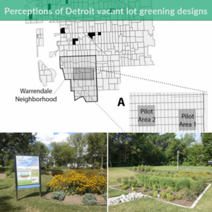
Read More »University of Michigan, School for Environment and Sustainability
A study led by the University of Michigan and the University of Michigan-Dearborn aims to understand the connection between vacant lot maintenance, such as greenwater storm infrastructure (GSI), and subsequent mental health effects.
Read More »Groundwork USA
The New Orleans Green Infrastructure Map is an ArcGIS map, created in partnership with Groundwork USA, Groundwork New Orleans and several community partners, seeks to document the various greening initiatives across the city of New Orleans.
Read More »Pennsylvania Horticulture Society (PHS)
The Green Equity Initiative by the Pennsylvania Horticulture Society (PHS) is a proposal for environmental neighborhood investment in Philadelphia in the form of neighborhood-based greening solutions.
Read More »Environmental Protection Agency (EPA)
The EPA Region 5 Brownfields Map is an ArcGIS visual of various brownfield redevelopment success stories in the Midwest. The map has 30 examples with descriptions of projects including environmental assessments, redeveloping spaces into medical complexes, housing, a museum, etc..
Read More »Lincoln Institute of Land Policy
The Greening America’s Smaller Legacy Cities from the Lincoln Institute of Land Policy is a policy-focused report on how local governments in small and midsize older industrial cities can adopt and implement comprehensive sustainability initiatives.
Read More »UConn College of Agriculture, Health and Natural Resources Doctoral Researcher Pan Zhang and Assistant Professor Sohyun Park
The Vacant Land Assessment System (VLAS) uses ArcGIS tools to create strategies for assessing and prioritizing vacant lots for their most suitable regeneration possibilities. The tool analyzes the geographical surroundings, potential repurposing strategies and property features to classify them and provide ideas for transforming the lots. The VLAS framework becomes a powerful strategy for future planning in a way that is collaborative across disciplines and stakeholders and assesses lots effectively.
Read More »Cornell University Legal Constructs Lab
The National Zoning Atlas enables users to visualize the prevalence and nature of regulatory constraints, particularly on housing. The Zoning Atlas is an important tool to help people understand what their local zoning codes say; compare codes across jurisdictions, illuminate regional and statewide trends, and strengthen national planning for housing production, transportation infrastructure, and climate response.
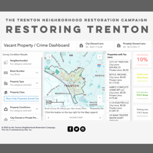
Read More »Trenton Neighborhood Restoration Campaign
In 2014, the Trenton Neighborhood Restoration Campaign (TNRC) organized the first truly comprehensive, parcel-level survey of all the vacant properties in Trenton — mapped, published, and updated on this interactive website. The TNRC also organized residents and local groups to draw attention to the problems caused by vacant and abandoned properties.
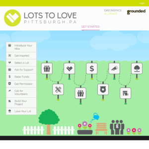
Read More »Grounded Strategies
Lots to Love is an online guide for community organizations and residents in the Pittsburgh region who are interested in transforming vacant lots into well-loved spaces. This website, created by the nonprofit Grounded Strategies, connects users to resources and ideas to support reuse of vacant lots, and provides information about organizations currently doing this work in the Pittsburgh region.
Read More »